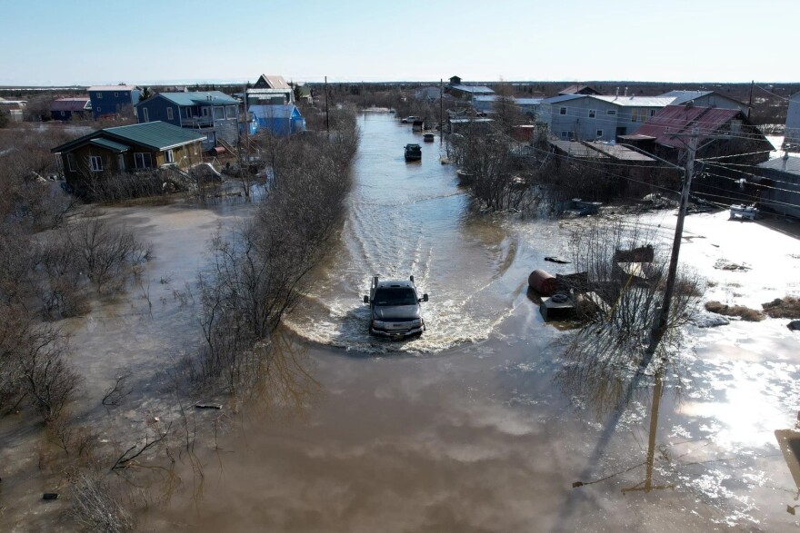
Amid historic breakup flooding on the Kuskokwim River, Gov. Mike Dunleavy on Friday issued a disaster declaration for lower Kuskokwim River communities. The declaration allows eligible communities and individuals to access state funds for emergency-related costs and it also activates other public assistance programs.
The declaration comes as icy water continues to flood multiple communities on the lower Kuskokwim.
The Kuskokwim River cut a channel through problematic ice jam below Bethel Thursday night and water levels dropped slightly. But by Friday morning, that area reportedly re-jammed, increasing flooding in Napaskiak, Oscarville, and Bethel. Upriver, Kwethluk continues to see flood impacts as well.
National Weather Service Hydrometeorologist Kyle Van Peursem joined KYUK’s morning show Coffee at KYUKon Friday.
“Until this ice jam can push further downstream, we're not going to have any improvement," Van Peursem said. "In fact, it's probably going to get worse."
There’s a flood warning in effect for the Kuskokwim River, Brown’s Slough and surrounding areas through Monday morning. Kwethluk is also on flood warning through midday Monday.
Roughly 6 miles downriver from Bethel, waters have continued to threaten Napaskiak, where the community’s airport has become an island only accessible by boat across a roughly half-mile stretch of water, according to Napaskiak resident Earl Samuelson.
As of Friday morning, Samuelson said that water had filled all of the low-lying areas in the community and was within 8 to 10 inches of inundating some homes. He said it is the highest water he has seen in Napaskiak since 1995.
“Folks that are out there traveling by boat, keep the weight down in front of town because these homes are critical right now,” Samuelson said.
Samuelson also said the school in Napaskiak is ready to be used as an evacuation shelter depending on what happens in the coming hours.
“If you're gonna to go to the school, please have a day pack or a backpack with extra food for a couple of days, water, medications and your important materials,” Samuelson said. “It might be a good time to pack that up in case we decide to do an evac or temporary at the school.”
Van Peursem with the National Weather Service said that small drops in river level are not necessarily an indication that the ice jam is starting to break up.
“We've seen the past 24 hours that kind of will go up, drop a little bit, go up, drop a little bit. There's no sign of it just dropping until that jam breaks,” Van Peursem said. “So expect flooding, and where people have seen flooding in Bethel, for the next day or so, if not more.”
Bethel’s city government announced Friday morning that areas impacted by flooding will not receive hauled water services until the river water recedes. That includes Main Street, Second, Third, Fourth, Fifth, Sixth and Seventh avenues, Bridge Street, Tundra Street, Alder, East Avenue, Hangar Lake and Osier Avenue.
As of 11 a.m. Friday, water levels at the Brown’s Slough gauge in Bethel were still the highest in decades at 11.48 feet, within a half-foot of what is considered moderate flooding, where evacuation of some homes can become necessary. On Thursday, the city urged residents to prepare for things to get worse, and for vehicles to stay away from the seawall due to soft and hazardous conditions.
Upriver, Kwethluk’s flooding continues to be the worst seen this breakup season so far. As of Thursday night, officials reported flooding rose 1-2 feet in the community.
“The Kwethluk River is completely full. In fact we flew up and you can even tell where the river was because the whole tundra up there was flooded with water," Van Peursem said. "We did get word this morning that the water levels increase look of stabilize. So I think that's a good sign that things are trending then in the positive in the right direction for them. So hopefully we've kind of crusted in terms of water levels.”
Van Peursem said that ice looks like it’s degrading below Napakiak and toward the Johnson River. He said that based on how the jam has been moving, or not moving, area residents can expect at least another 24 hours of rising water.
Breakup and flood-related information can change quickly, and this article may be updated to reflect more current information.
Share photos or observations with KYUK at 907-543-0223 or by emailing news@kyuk.org .
Correction: An earlier version of this story incorrectly stated that the disaster declaration applied to lower Yukon River communities.

