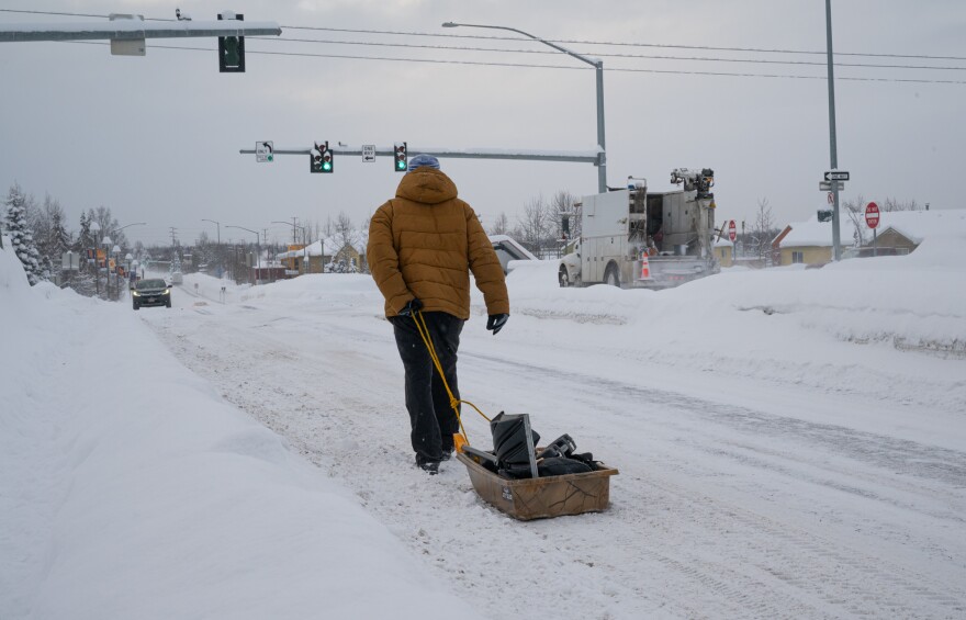
Anchorage set several daily and monthly snowfall records this winter, with more than 10 feet of snow dropping on town. But it doesn’t look likely the city will break its all-time record of 134.5 inches of total snowfall for the season.
That’s according to National Weather Service climate researcher Brian Brettschneider, who joins us for our regular Ask a Climatologist segment.
Brettschneider says the city has only got about a foot of snow to go to beat the record, but he doesn’t see it happening.
Listen:
This interview has been edited for length and clarity.
Brian Brettschneider: So in Anchorage, we are about 12 inches shy of setting the new record. If no more snow fell the rest of the season, it would still be the fourth snowiest winter season on record. So from this point onward, we average only about seven or eight inches of snow the rest of the season, and only about one out of every five years would have enough snow the rest of the way to end up breaking the record. So it's not looking real good for setting that record. Of course, it just takes one big snow event.
Wesley Early: And I'm curious, is there any indication of when the last snowfall could be? You know, when people can expect, maybe now's a good time to take off the snow tires?
BB: Well, that's really hard to say. Typically, the long-term average is that the snow goes away completely around April 14 or 15. But of course, the roads are a lot clearer. They're usually free of snow and ice well before then. So I know driving around town right now, most roads are free and clear of ice. Of course, we're getting a lot of melting and refreezing in the morning. So it's been quite slick the last few days.
WE: So we were in an El Niño winter, which means that it was set to be a little warmer than normal. Maybe it didn't feel that way because of all the snowfall. Did we actually have a warmer than normal winter due to El Niño?
BB: Well, there's a couple of ways to think about it. If you just add up all the highs and lows kind of statewide, and you say, “Well, how did the numbers shake out,” we ended up almost exactly normal, as far as when you compare to the most recent period from 1991 to 2020. Although historically, we were a couple degrees warmer than normal if you look at long-term. But for an El Niño winter, we were quite a bit cooler than normal. We were probably about five degrees cooler than what we would expect going into an El Niño winter. So we were kind of the one cooler-than-normal bullseye to that extent, really for all of North America and most of the Northern Hemisphere.
WE: And is there any reason why that sort of warmer winter didn't come?
BB: You can look day to day or week to week and evaluate the atmospheric flow, and we ended up with maybe more northerly flow than we would have ordinarily expected. But almost everyone else was above normal. Just one small area was less warm than normal, and that was us. And that's just really impossible to forecast at the seasonal timescale. We just really kind of won the luck of the draw. For North America as a whole, it was by far the warmest winter on record. For the Lower 48 it was the warmest winter, for Canada it was the warmest winter, for all of North America it was the warmest winter. For all of the northern hemisphere and for all the world, it was the warmest.
WE: Yeah, it's interesting, you know, we also had a more cool summer while everybody else was sort of having a really, really hot summer. And it seems that we had this cooler winter while everybody else was having a warmer winter. Is that sort of any indication of how things will be moving forward, it was kind of like a freaky year?
BB: So we didn't really have a very cool summer by historical standards. It was cool compared to say the last decade, but it's a very typical summer. The fact that we had a not-as-warm summer as we could have had and a not-as-warm winter as we could have had, is there any correlation between those two? No, they really function independently. And, you know, parts of northern Europe, Scandinavia in particular, they've had a run of cool months in a row, about six months in a row. Whereas, you know, region-wide, it's been very warm. So they were kind of a little cool bullseye as well. So there's just a lot of randomness to the climate system at that timescale. And we really can't look forward to make any kind of extrapolation. So if we look back at the last really strong El Niño in 2015-16, we were the unusually warm spot. We were much warmer than everybody else, compared to normal. And a lot of people were asking, oh, what does this mean, why were we in Alaska particularly warmer? And so we're getting to the flip side right now, we just kind of got lucky as it were.
WE: And as you mentioned, we're about a month out from when it's expected that all the snow is gonna be melted. Is there any forecast for what spring and summer, or breakup and construction season, are gonna look like?
BB: So just


