There’s not a great written record of urban avalanches in Juneau. There was a well documented big one in 1962, but most of what we know about destructive slides from before that comes from one lost photograph and stories from old-timers. There is, though, a vast library of climate data and avalanche records that goes back more than a thousand years — it’s inside the region’s trees.
On the side of Mount Juneau: Yadaa.at Kalé there’s a swath of the mountain that has been scoured year after year by avalanches. It’s called the Behrends path because it crosses over Behrends Avenue in a downtown subdivision. There are about two dozen houses there, which study after study has determined are in an unacceptably dangerous place.
The avalanche path itself doesn’t have trees, just a tangle of alder and other bright green spring bushes. But there are trees along its edge, and Erich Peitzsch with the U.S. Geological Survey is visiting from Montana to collect data from those trees.
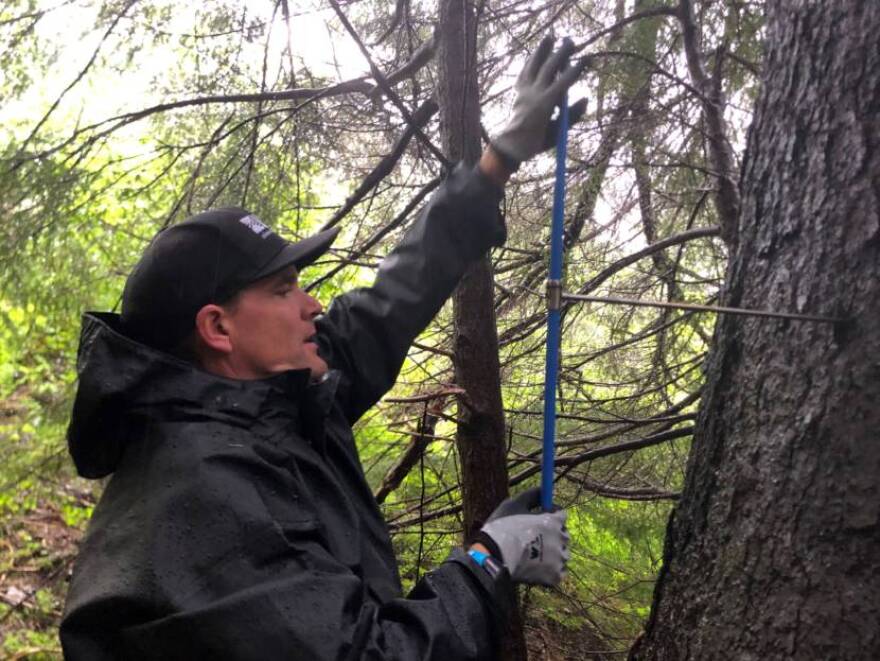
He drills into a big evergreen with a long, thin, corkscrew instrument called an increment borer, which he says doesn’t hurt the tree. It has a nice long handle for leverage, so it looks a little like he’s changing a tire on a giant Sitka spruce.
It’s not backbreaking work, but it’s hard. Peitzsch and his colleagues are going to sample at least 70 trees over three days. One of the grad student’s hands are all bandaged up from gnarly blisters he got cranking on the borer all day.
When the core comes out, it’s thinner than a pencil and about four times as long. The rings will have to be counted under a microscope in a lab. In addition to figuring out how old these trees are, Peitzsch and his team are also looking for telltale signs of avalanches.
When an avalanche hits a tree but doesn’t knock it over and kill it, it can leave a scar on the uphill side — a place where the bark is gone, leaving a kind of bumpy ridge on an otherwise perfect column of tree trunk. Under the microscope it looks like a little black line on the tree ring for that year.
Juneau is unique in how much of the city is at risk from avalanches.
“In all the places I’ve worked and lived — in Colorado and other places, I’d never seen that many houses right at the bottom of a major path,” said Eran Hood, one of the local researchers from the University of Alaska Southeast.
By looking for clues in the tree rings, these researchers are trying to reconstruct the frequency of avalanches all around the region — especially in places with impact to human infrastructure like power plants, mines, houses and the ski area. Eventually, they’d like to match that timeline to climate data.
Avalanche mitigation often takes the form of intentionally setting off small slides with explosives to sort of relieve the pressure for potential big ones, which is what Alaska’s Department of Transportation does along a stretch of highway that goes to Juneau’s Thane neighborhood.
“You close the road, you bomb it, the avalanche comes down, and you clean it up,” Hood said. “But that’s not an option here in the Behrends path.”
It’s way too dangerous to set off small avalanches above the Behrends neighborhood. The path is just too steep, and it’s too hard to control how much snow might come down. Houses could get hit, people could get hurt. You could evacuate the homes while you did it, but then you’d also have to close the main road that connects downtown Juneau to its only hospital.
So far these researchers have crunched the numbers for six different avalanche paths around Juneau, going back more than 500 years. They found that regionwide the median return rate for damaging avalanches was nine years.
A 2011 study estimated that an avalanche reaches the Behrends neighborhood every 15 years. And every 20-30 years, there’s a slide big enough to cause damage to those homes. But that’s a number based on data and models. In reality, Hood says, it’s been much longer than that since there was a big one here.
“There hasn’t been a big avalanche into town really in more than 50 years that’s done damage,” he said. “And so if you think about that, as a generational timescale, there are not a lot of people living here that are that worried about it, right?”
Ten years ago, that study by some Swiss engineers recommended that the best way to reduce the risk of a dangerous avalanche in the Behrends neighborhood is for the city to buy out the houses in the danger zone and make sure no one lives at the bottom of that hill. It wasn’t the first time that had been recommended. But the city has never been willing or able to do that. And when the city asked residents in the path if they were interested in getting bought out, they received very little response.
So scientists and policy makers keep studying in finer and finer detail a risk that you can see plain as day from just about anywhere in town. And, on top of that, they’re trying to figure out what wetter, warmer weather might mean for these trees, this hillside and the people living down below.


