The wildfires around Nulato and Ruby on the Yukon River have been burning slowly but steadily this week. The Nulato Fire has covered more than 26 thousand acres, while a series of fires around Ruby have burned close to 65 thousand acres.
A special crew of fire managers is overseeing the response to these fires from a base at the Galena Airport. The managers are being assisted by computers that help predict the future of a wildfire.
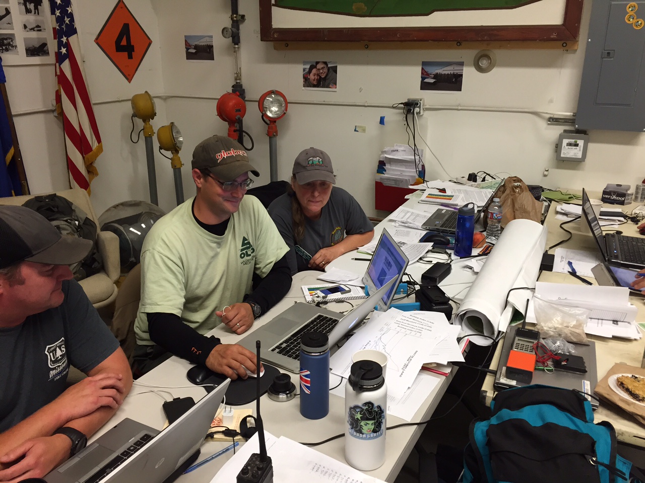
Sam Amato and Risa Lang-Navarro are sitting at a table in a windowless room, bank of laptops open in front of them. They are the analysts on Diane Hutton’s Northern Rockies Fire Management Team, which is in charge of fires near the villages of Ruby and Nulato. While other firefighters live in a world of Pulaskis, chainsaws and pumps – these two live in a world of data.
Temperature, wind speed, humidity, fuel type, fire behavior, satellite imagery, topography, and lots of other variables go into the computer models that Amato and Lang-Navarro run on their laptops – and what you get are predictions. It’s like a weather forecast, except with fire, showing where the fire is likely to move and how quickly it will get there.
Sam Amato is the long term analyst on the team. Even though the fire prediction models draw from reams of information in databases and coming in from automated weather observation stations, Amato says that the models still rely on human input to make them work well. “They are very rough estimates. So we depend a lot on information coming back from the field to help me pick the correct weather station, help me calibrate the fuels, ,change the fuel models to be more representative . Typically it will take between 3 days and a week to get the models where they are really helpful to the field, unless you are in a unit where there is a lot of fire activity, then they tend to have those pre-calibrated because they are doing this so much on that particular unit.”
Risa Lang-Navarro works more in the short term. As the fire behavior analyst it’s her job to get forecasts to fire crew in the field for the next day or two, while Amato often looks a week or two into the future.
She too believes that it is important to get away from the desk and see the fire with her own eyes. “Not only looking at the fuels and topography out there, but also interacting with the crews and getting their feedback. Because I basically put a fire behavior forecast together and a spot weather forecast together and then it is out in the field. So getting that feedback, saying ‘OK, am I getting what you guys are seeing out in my forecast. Do I need to change anything? Or do you need anything else.’”
This past week on the Nulato Fire, the analysts used the computer models to simulate an expansion of the fire to more cabins and allotments upriver to the northeast, and found that if firefighters concentrated their efforts on two particular hot spots, the chances of that expansion were significantly lower. So on Thursday fire managers assigned a helicopter to drop water on those hotspots.
That’s an example of how managers, like Incident Commander Diane Hutton, have come to embrace computer predictions as a way to eliminate much of the guesswork and allocate resources more effectively. “And they’ll tell us approximately the probability of when structures or values at risk are going to be impacted, so we know if we have time to get out in front and get some of that done. So they help us on our prioritization on the fire, of where we need to be putting our people.”
Hutton has been an incident commander for 6 years, and remembers a time when a couple of people with laptops would not have been able to drop into a remote site and do the kind of computer modeling that they do today. “Used to take big computers and big servers to run some of the models that they run. You couldn’t just run them out in the field. And that has improved probably just in the past couple of years. Of course you have to have an internet connection, and we been able to do that in the past. Our team usually gets stuck in some little cabin out in the middle of the wilderness someplace, and so the fact that we can bring in satellite dishes now and have internet connectivity about anywhere we go has made us be able to use that resource without having to do it from a remote station.”
The main challenge with the whole system is a familiar one to many rural Alaska residents: slow internet speeds.


