By Dustin Solberg
Sure, all natural habitats are important. But some have a special power – for both nature and people. That’s the case for the estuary, that place where the world’s three most dominant natural realms meet.
Research by two Nature Conservancy scientists, “An Estuarine Classification for a Complex Fjordal Island Archipelago,” recently appeared in the journal Estuaries and Coasts. The article is a helpful tool for planning how to conserve the most biologically rich habitats in regions such as the Tongass of Southeast Alaska.
Much like a biological species classification, a habitat classification provides a set of principles that organize the complexity we see in the world.
Study co-author and science director for the Conservancy’s Alaska program Dave Albert recently discussed the hold estuaries have on so many species – including us – with Cool Green Science blogger Dustin Solberg.
Dustin Solberg: To begin, what is an estuary?
Dave Albert: The estuary is the intersection of the three dominant realms on earth: the terrestrial environment, the freshwater environment, and the marine environment. That place where all those things come together.
Dustin Solberg: How does this combination of three realms affect biodiversity?
Dave Albert: First, remember that the shoreline is a really hostile environment for most organisms. They have to be both able to live submerged in saltwater but also able to tolerate exposure to the air – twice a day – and all that involves. Either heat, or freezing, or drying.
The estuary is a special case of that. It’s the place where the river mouth intersects with this shoreline environment. So not only do we have drying and soaking in saltwater but also periodic exposure to both saltwater and freshwater, which it turns out is a really challenging place for aquatic organisms to deal with.
But because of that, the estuary is a refuge for some organisms that can adapt.
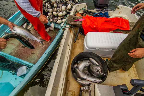
In fact, we see the estuary as a nursery ground for juveniles of lots of species – such as salmon and other commercially valuable fish and shellfish. It’s a harsh environment, so there’s less competition. For instance, the crowding of barnacles and clams that you see in the shoreline environment? You don’t see that in the estuary because of the dynamics of the shoreline. It’s not a constant environment. It’s always changing.
Dustin Solberg: What role do estuaries serve in people’s lives?
Dave Albert: Major cities in the world, such as London, San Francisco, New York, Seattle, are all located on estuaries because of the productivity and the transportation functions that estuaries provide. As a result, temperate bays and estuaries are one of the most threatened ecological types on Earth. They’re highly productive. They’re very rare, and just because of the way humans have developed the landscape over time, they’re the places that we live.
As we think of a region like Southeast Alaska, it’s really striking the degree to which the majority of things we do in the region happen right along the shoreline.
Dustin Solberg: You co-authored an estuary habitat classification published in the scientific journal Estuaries and Coasts. What approach did you use to classify estuaries in Southeast Alaska?
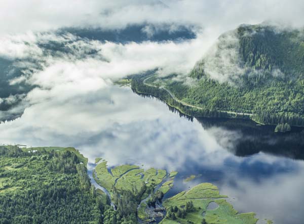
Dave Albert: Southeast Alaska is a huge region, with something like 19,000 miles of shoreline. And about 12,000 estuaries.
So the classification is a simple model to test our understanding of the relationships between physical conditions and the species likely to be found in these places. For example, at a regional scale we used sea-surface temperature and ocean salinity to differentiate between estuaries exposed to the open Pacific Ocean that are generally saltier and warmer, and estuaries of the inside waters which tend to be freshwater-dominated and have cooler temperatures.
At a more localized scale, the size of the watershed and degree of glacial influence will determine how much sediment and nutrients are transported into the intertidal and marine environment. Also, the ocean depth and degree of exposure to scouring waves determines whether those sediments are retained in a tidal mudflat or transported away to leave a rocky shoreline.
These are key factors that determine the types of habitats and species that will make the estuary home.
Dustin Solberg: Now that the estuary classification is complete, how are you putting this tool to work?
Dave Albert: The variation in the physical characteristics of the shoreline has a lot of power to explain the biota that we find living there. So that’s where the classification comes in. What a classification does is it takes this huge amount of variability in freshwater, and saltwater, and the terrestrial environment, and it organizes it in a way that makes it useful. For our purposes, it was to be useful for conservation planning – and specifically to better predict biodiversity and what the ecological functions of particular places are going to be.
Dustin Solberg: You live, work and play in the estuaries of Southeast Alaska. Can you give us a sense of what you see as you travel the coastline?
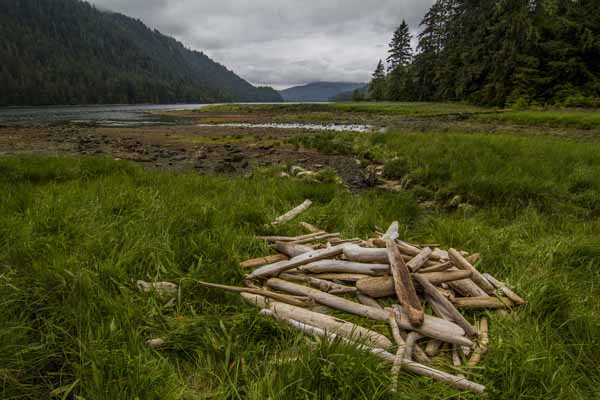
Dave Albert: When you travel by boat across this region, there are miles and miles of shoreline: forested shorelines, rocky shores, boulders, et cetera. And every time you get to one of these classic estuaries – with a valley bottom that dumps out with a big tide flat and salt marsh habitat, it’s going to be rich.
I took a trip on Chichagof Island a couple of years ago, and we saw brown bears in every single estuary we went to, as well as lots of geese, ducks, cranes and deer. And you walk around them and you see brown bear tracks that are like little highways. They’re just very, very exciting places.
Funding for this research project was provided by the Alaska Department of Fish and Game, Coastal Impact Assessment Program, Gordon and Betty Moore Foundation, NOAA National Marine Fisheries Service, Royal Caribbean Cruises Ltd./Ocean Fund, and the Skaggs Foundation.
The Nature Conservancy is the leading conservation organization working around the world to protect ecologically important lands and waters for nature and people.


