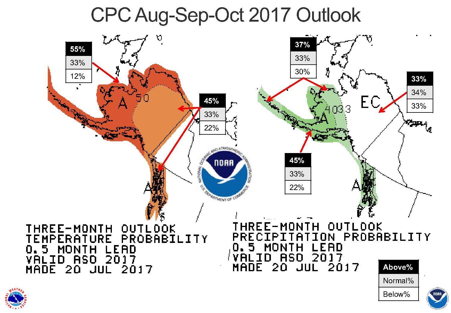
National Weather Service climate expert Rick Thoman said there’s a good chance that all of Alaska will be warmer than normal in August and the next couple of months. But he said there’s near-certainty that coastal areas along the Gulf of Alaska and the Bering and Beaufort seas will be warm through October.
Thoman said the computer models and array of sensors that he and other climate experts use to develop long-term forecasts suggest there’s a 45 percent chance that the eastern and central Interior will be warmer than normal through October. He said that’s a statewide trend that’s developed in recent years.
“The early Autumn season over most of the state, except for Southeast, in the last decade there’s been a really quite strong trend for a warm early Autumn season,” he said.
But Thoman said the models show an especially strong likelihood of warmer-than-normal temperatures in coastal areas through late summer and early fall. He said that’s mainly due to warm sea-surface temperatures and the absence of sea ice in the Bering and Beaufort seas.
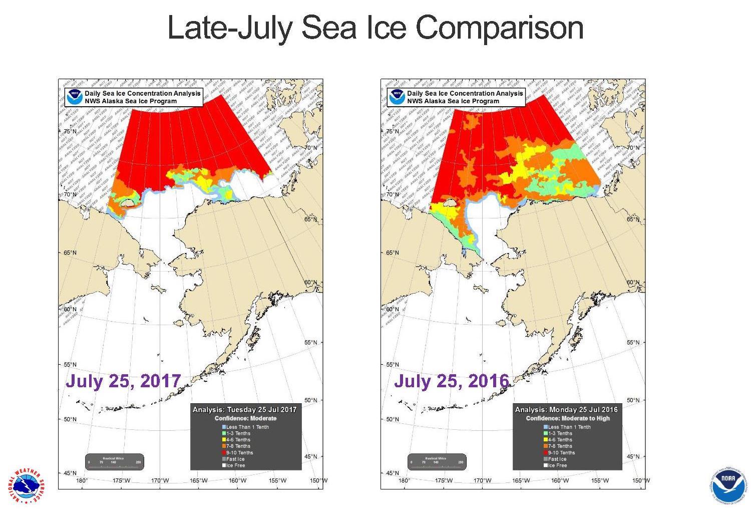
“Especially over northern and western Alaska – very low sea-ice cover,” Thoman said. “The ice cover left very early, even by modern standards, across the North Slope.”
Thoman said when Arctic sea ice cover retreats northward to its so-called minimum extent sometime in September, it probably won’t break the minimum-extent record set in 2012. But he said years of warming in the Arctic make it certain that it’ll be near the top of the list.
“It’s not a question of is it going to be above or below normal,” Thoman said. “The only real question is will it be the lowest? Will it be the second-lowest? Or will it be the third-lowest?
The Colorado-based National Snow and Ice Data Center reports Arctic sea-ice extent in early July appeared to be receding at a rate that rivaled the early July 2012 extent. But the rate of sea-ice decline slowed by mid-month, NSIDC says.
Thoman said precipitation is harder to predict a month out than it is for temperatures. But he said the models suggest near-normal precipitation throughout much of the state through October – except along the Bering Sea coast and Southeast Alaska, where higher-than-normal precipitation is likely.
Tim Ellis is a reporter at KUAC in Fairbanks.


