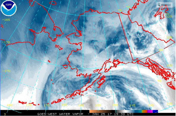
After about a week of negative double-digit temperatures, rain and warmer weather is expected throughout much of Southcentral Alaska this week.
Jason Ahsenmacher, a meteorologist with the National Weather Service in Anchorage, said a weather system is moving in from the North Pacific.
“What we expect is that warm front to bring in much more moist, much warmer air into all of Southcentral, really,” Ahsenmacher said.
Ahsenmacher expects the system to move into the area Wednesday and stick around through Thursday. Rain is forecast for Anchorage and Seward, and he said Turnagain Pass should see significant snowfall.
“Accompanying that rain and snow we’re going to be seeing strong winds coming down Turnagain Arm and Portage Valley, 50-60 mph – possibly gusts even higher than that,” Ahsenmacher said.
The state Department of Transportation is still cleaning up from last weekend’s storms, which brought heavy snowfall throughout much of Southcentral.
And now, DOT spokesperson Shannon McCarthy said the agency is preparing its response to the incoming change in weather.
“We have our crews on call; we’ve staged equipment that is particularly effective with removing ice,” McCarthy said. “And we also are getting ready, if we need to, to use rock salt to prevent ice buildup.”
McCarthy said DOT typically pre-treats roads with a salt brine – a mix of salt and water – but it’s not as effective in the anticipated weather conditions as rock salt.
A mix of rain and snow showers and temperatures reaching into the 40s are forecast over the next couple of days in Anchorage and Seward.
Josh is the Statewide Morning News Reporter/Producer for Alaska Public Media | jedge (at) alaskapublic (dot) org | 907.550.8455 | About Josh


